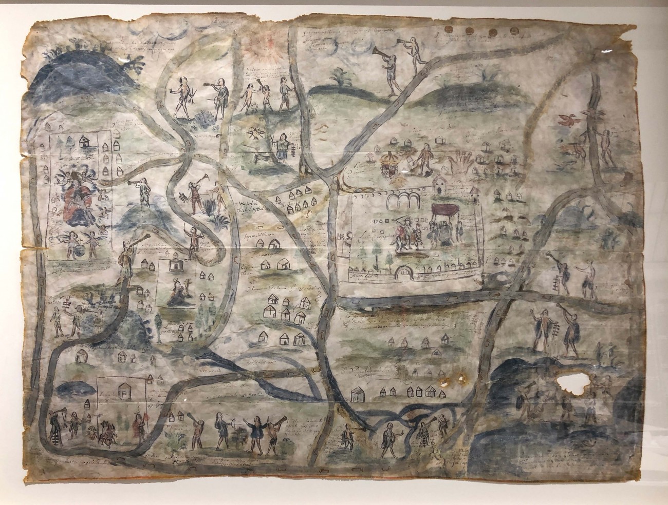
Map of Santiago Quanepopohualco, Xomolco, San Martin Quatzotzoco, Hidalgo, 1532 (2021 copy)
Audio Guide
This facsimile map offers an evocative example of the Mesoamerican cartographic tradition, in which place is rendered inextricable from the histories lived within it. We see a landscape, perhaps in the modern-day state of Morelos, Mexico, with a walled church at its center and houses nestled throughout. Heralds and archers traverse footpaths, wending their way through hills and rivers painted in deep blue hues. Though much of it remains enigmatic, the map tells a story of the evangelization of this region, uniting time and space in a single image. Among the names inscribed on this map is that of Indigenous tlacuilco (scribe) Manuel Juárez Mexicatl.

